This is the quiz for the airspace lesson
Drone Airspace
Quiz Summary
0 of 7 questions completed
Questions:
Information
You have already completed the quiz before. Hence you can not start it again.
Quiz is loading…
You must sign in or sign up to start the quiz.
You must first complete the following:
Results
Results
0 of 7 questions answered correctly
Your time:
Time has elapsed
You have reached 0 of 0 point(s), (0)
Earned Point(s): 0 of 0, (0)
0 Essay(s) Pending (Possible Point(s): 0)
Categories
- Not categorized 0%
- 1
- 2
- 3
- 4
- 5
- 6
- 7
- Current
- Review
- Answered
- Incorrect
-
Question 1 of 7
1. Question
Refer to the diagrams below, area 3. Determine the approximate latitude and longitude of Currituck County Airport.

 CorrectIncorrect
 -
Question 2 of 7
2. Question
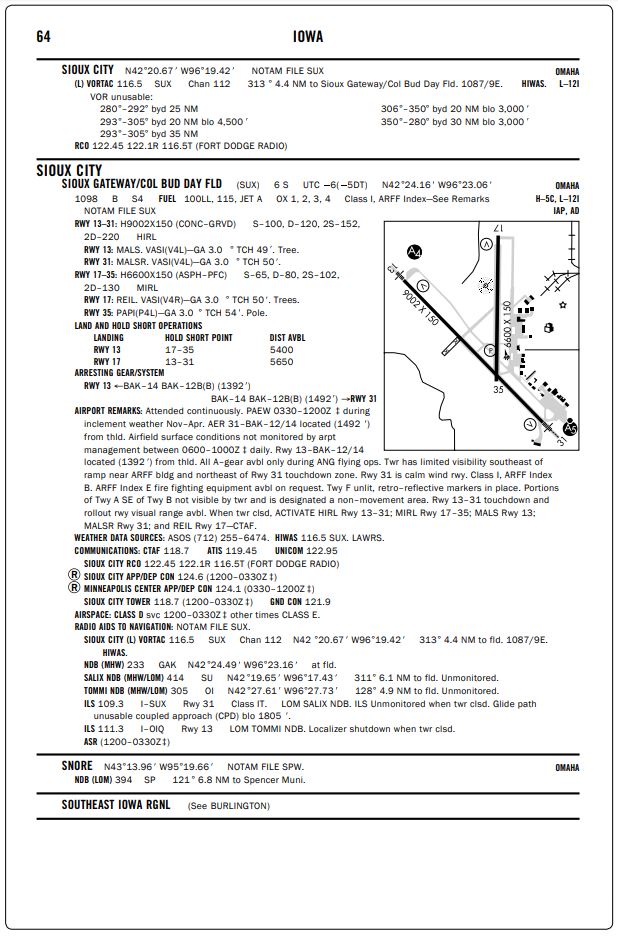
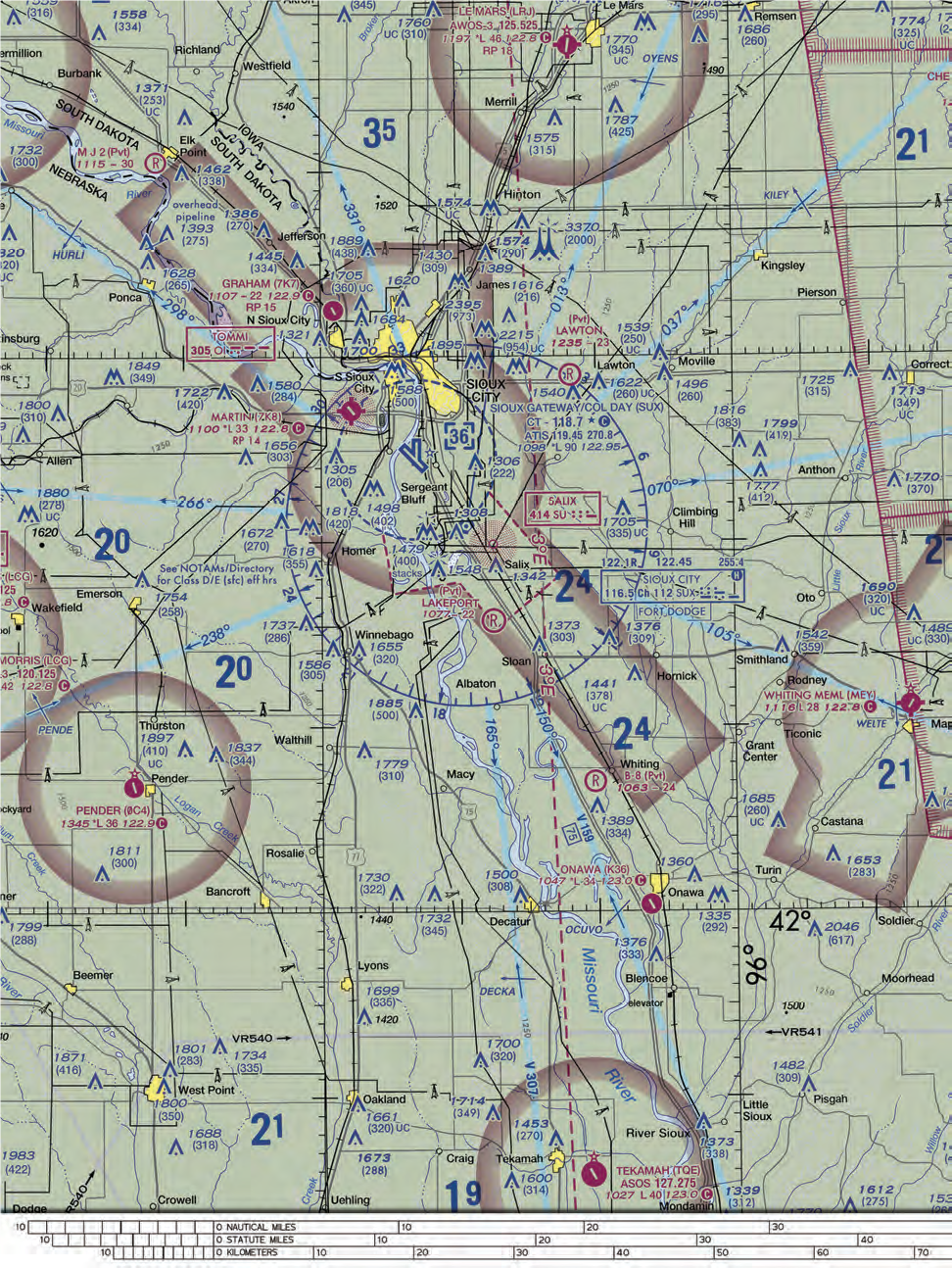
Refer to the diagrams below. At Sioux Gateway/Col Day (N42 degrees 20.67′) W 96 degrees 19.42′), which frequency should be used as a Common Traffic Advisory Frequency (CTAF) to self-announce position and intentions when the control tower is closed?

 CorrectIncorrect
 -
Question 3 of 7
3. Question
Refer to the diagram below, area 1. The NALF Fentress (NFE) Airport is in what type of airspace?
 CorrectIncorrect
 -
Question 4 of 7
4. Question
Refer to the diagram below, area 4. What hazards to aircraft may exist in restricted areas such as R-5302A?
 CorrectIncorrect
 -
Question 5 of 7
5. Question
Refer to the diagram below, area 1. What minimum radio equipment is required to land and take off at Norfolk International?
 CorrectIncorrect
 -
Question 6 of 7
6. Question
Refer to the diagram below, area 2. The elevation of the Chesapeake Regional Airport is
 CorrectIncorrect
 -
Question 7 of 7
7. Question
What color is the sky?
CorrectIncorrectHint
Look up!